Category:Islands
From Wikimedia Commons, the free media repository
| Category Islands on sister projects: | |||||||||
|---|---|---|---|---|---|---|---|---|---|
Wiktionary |
Commons |
Wikiquote |
|||||||
Azərbaycanca: Ada — hər tərəfdən su ilə əhatə olunmuş, materikə nisbətən kiçik, suyun qabarması zamanı belə su səthindən yüksəkdə olan, təbii yolla yaranan quru torpaq sahəsi.
Bahasa Indonesia: Pulau adalah sebidang tanah yang lebih kecil dari benua dan lebih besar dari karang, yang dikelilingi air.
Bahasa Melayu: Sebuah pulau adalah bidang tanah yang lebih kecil dari benua dan lebih besar dari karang, yang dikelilingi air.
Brezhoneg: Un enezenn zo un douar gronnet gant dour.
Català: Una illa és un territori terrestre envoltat d'aigua, sigui de mar, de riu o de llacs.
Čeština: Ostrov je kus pevniny, menší než kontinent a větší než skála, který leží na vodě.
Cymraeg: Darn o dir a amgylchynnir gan ddŵr yw ynys.
Dansk: En ø er et landområde helt omgivet af vand ved normalvandstand, der er mindre end et kontinent og større end en sten eller et skær.
Deutsch: Eine Insel ist ein Stück Land, welches kleiner als ein Kontinent und größer als ein Felsen und komplett von Wasser umgeben ist.
Eesti: Saar on täielikult veega ümbritsetud maismaa.
English: An Island is any piece of land smaller than a continent and larger than a rock, that is completely surrounded by water.
Español: Una Isla es una porción de tierra que se encuentra totalmente rodeada de agua.
Euskara: Uharte edo izaroa alde guztietan urez inguratuta dagoen lur eremua da.
Føroyskt: Ein oyggj er land við sjógvi í allar ættir.
Français: Une île est une zone émergée plus petite qu'un continent et plus grande qu'un rocher, entièrement entourée d'eau.
Frysk: In eilân is in lânoerflakte dy't oan alle siden troch wetter omklamd is, mar lytser is as in kontinint en grutter as in rots of in plaat.
Gaeilge: Is éard atá i gceist le hoileán ná tírghné (nach mór-roinn í) atá timpeallaithe le huisce.
Gàidhlig: 'S e eilean fearann a tha uisge ceithir timcheall air.
Galego: Unha illa é unha extensión de terra rodeada de auga por todas partes.
Hrvatski: Otok je dio kopna manji od kontinenta a veći od hridi.
Íslenska: Eyja er landslagsþáttur sem er minna en meginland en stærra en sker og umkringt vatni.
Italiano: Un'isola è una terra emersa interamente circondata dalle acque e di dimensioni ridotte rispetto ad un continente.
Latviešu: Sala ir sauszemes daļa, ko no visām pusēm pilnībā aptver ūdens un kas nav savienota ar citu sauszemi.
Lietuvių: Sala – žemės plotas, iš visų pusių apsuptas vandens.
Magyar: A sziget egy olyan szikláknál nagyobb, ám kontinenseknél kisebb földdarab, melyet víz vesz körbe.
Nederlands: Een eiland is een landoppervlakte dat aan alle kanten omringd is door water, maar kleiner is dan een continent en groter dan een rots of een zandbank.
Norsk bokmål: Ei øy er et landområde som er mindre enn et kontinent og større enn en stein eller et skjær, og som er helt omgitt av vann ved normal vannstand.
Norsk nynorsk: Ei øy er eit landområde som ikkje er bunde fast til eit kontinent.
Occitan: Una illa es una parcèla de tèrra completament enrodada d'aiga.
Polski: Wyspa – trwały fragment lądowej powierzchni Ziemi, który jest otoczony ze wszystkich stron wodą.
Português: Uma Ilha é uma porção de terra que se encontra totalmente totalmente rodeada de água.
Română: O insulă este o bucată de pământ mai mică decât un continent care este înconjurată complet de ape.
Shqip: Ishulli është pjesë tokësore e cila është e rrethuar nga të gjitha anët me ujë.
Slovenčina: Ostrov je pevnina menšia ako kontinent a väčšia ako skala, ktorá je zo všetkých strán obklopená vodou.
Slovenščina: Otok je del kopnega sveta, obdan z vodo.
Suomi: Saari on veden kokonaan ympäröimä mannerta pienempi maa-alue.
Svenska: En ö är ett landområde helt omgivet av vatten, mindre än en kontinent och större än en holme.
Tagalog: Ang pulo ay isang bahagi ng lupa na higit na maliit sa kontinente at higit na malaki sa bato na napaliligiran ng tubig.
Tiếng Việt: Đảo là phần đất được bao quanh hoàn toàn bởi nước nhưng không phải là một lục địa.
Türkçe: Ada, çevresi bütünüyle sularla çevrili kara parçasına verilen addır.
Српски / srpski: Острво је део копна мањи од континента а већи од хрида.
Башҡортса: Утрау - тирә-яғынан һыу уратҡан ҡоро ер, ҡитғанан бәләкәсерәк
Беларуская: Востраў — участак сушы, які з усіх бакоў абкружаны водамі акіяна, мора, возера або ракі.
Български: Остров се нарича парче суша, по-малко от континент, но по-голямо от скала, заобиколено изцяло от воден басейн.
Македонски: Остров е копно опколено од сите страни со вода.
Русский: Остров — участок суши, окружённый со всех сторон водой и постоянно возвышающийся над водой даже в период наибольшего прилива.
Українська: Острів — частина суходолу, оточена з усіх сторін водою.
Ελληνικά: Νησί είναι ένα μεγάλο κομμάτι ξηράς που περικλείεται από νερό, ανεξαρτήτως του εάν βρίσκεται σε λίμνη, σε ποτάμι ή στην θάλασσα.
Հայերեն: Կղզի, բոլոր չորս կողմերից ջրով շրջապատված ցամաքի կտոր։
ქართული: კუნძული — ხმელეთის მონაკვეთი, რომელიც ყოველი მხრიდან გარემოცულია ოკეანის, ზღვის, ტბის ან მდინარის წყლით.
मैथिली: द्वीप स्थलखण्ड कऽ एहन भाग होएत अछि, जेकर चारो दिशा जल कऽ विस्तार पावल जाइत अछि ।
हिन्दी: द्वीप स्थलखण्ड के एसे भाग होतें हैं, जिनके चारों ओर जल का विस्तार पाया जाता हैं ।
ਪੰਜਾਬੀ: ਟਾਪੂ ਉਸ ਭੂ-ਭਾਗ ਨੂੰ ਕਿਹਾ ਜਾਂਦਾ ਹੈ ਜੋ ਕਿ ਚਾਰੇ ਪਾਸਿਓਂ ਪਾਣੀ ਨਾਲ ਘਿਰਿਆ ਹੁੰਦਾ ਹੈ। ਇਹ ਪੱਥਰ ਤੋਂ ਵੱਡਾ ਤੇ ਮਹਾਦੀਪ ਤੋਂ ਛੋਟਾ ਹੁੰਦਾ ਹੈ।
தமிழ்: தீவு அல்லது என்பது நான்கு புறமும் கடல், ஏரி, ஆறு போன்ற நீர்ப்பரப்புகளால் சூழப்பட்ட ஒரு நிலப்பகுதியைக் குறிக்கும்.
ไทย: เกาะเป็นพื้นดินที่ล้อมรอบด้วยน้ำ
한국어: 섬은 물로 완전히 둘러싸인 땅으로서 대륙보다 작고 암초보다 큰 것을 말한다.
日本語: 島(しま)は、オーストラリア大陸の面積より小さく、四方を水域に囲まれた陸地をいう。
中文(简体): 岛屿或岛是指四面环水并在涨潮时高于水面的自然形成的陆地区域(根据《联合国海洋法公约》)。
中文(繁體): 島嶼或島是指四面環水並在漲潮時高於水面的自然形成的陸地區域(根據《聯合國海洋法公約》)。
עברית: אי הוא שטח אדמה אשר מוקף מים מכל קצוותיו אשר קטן מיבשה וגדול מסלע.
العربية: الجزيرة هي منطقة من اليابسة محاطة بالمياه من جميع الجهات، ولا ترقى مساحتها لتكون قارة
فارسی: جزیره خشکی است که گرداگردش را آب فرا گرفته باشد.
Subcategories
This category has the following 25 subcategories, out of 25 total.
*
+
?
A
B
C
G
I
P
R
T
Media in category "Islands"
The following 200 files are in this category, out of 327 total.
(previous page) (next page)- 095 Quimperlé.jpg 3,648 × 2,736; 4.13 MB
- 15.08.01 - Itacuruçá RJ.jpg 2,048 × 1,152; 633 KB
- 191 L'Isole à Cascadec.JPG 3,072 × 2,304; 4.61 MB
- 2016.05.14 - Lapinha MG (6).jpg 4,288 × 3,216; 7.65 MB
- 20170203- MG 3313.jpg 4,990 × 3,327; 13.32 MB
- 3D Profile of Chac Island from from the West.jpg 745 × 256; 7 KB
- A tricky transfer (7033582425).jpg 732 × 726; 272 KB
- ABROLHOS BA3.PNG 1,920 × 1,440; 1.94 MB
- Akun island image.jpg 3,000 × 2,000; 471 KB
- Am See.JPG 1,100 × 744; 219 KB
- Amagat island nature.jpg 1,050 × 707; 146 KB
- Antonina - PR- BRASIL.png 479 × 475; 319 KB
- Ao Leuk beach in Ko Tao - Thailand - panoramio.jpg 2,304 × 1,728; 787 KB
- Approaching storm at Lasikin Beach.jpg 2,196 × 1,544; 2.5 MB
- Arabian Oryx Sir Bani Yas Island 2.jpg 2,117 × 1,411; 2 MB
- Arabian Oryx Sir Bani Yas Island.jpg 5,110 × 3,328; 2.3 MB
- Batsata rock from Paulsberg.jpg 1,197 × 795; 155 KB
- Beatiful Island of Java.jpg 4,608 × 3,456; 4.16 MB
- Beautiful view from Pura Island - Alor - East Nusa Tenggara.jpg 4,032 × 3,024; 3.02 MB
- Beautiful View from Ternate island - Alor - East Nusa Tenggara.jpg 4,032 × 3,024; 2.47 MB
- Bigmolley.jpg 960 × 720; 102 KB
- Bodleian Libraries, Capt. Cook's last voyage to the Pacific Ocean.jpg 785 × 1,000; 102 KB
- Bodleian Libraries, Game of swanhopping- Swanhopping.jpg 1,000 × 762; 120 KB
- Bodleian Libraries, New duck hunting game.jpg 1,000 × 759; 132 KB
- Bound for Laysan Island (6887769946).jpg 914 × 660; 189 KB
- Break in the Harbour of Seydisfjördur (Island).jpg 3,072 × 2,304; 3.7 MB
- Breakfast with gazelles.jpg 6,144 × 4,096; 8.2 MB
- Büyükadaİskelesinovember2016.png 1,200 × 798; 1.72 MB
- Cabo Peñas. Asturien. Spanien.jpg 2,000 × 1,500; 822 KB
- Cala iris Island.jpg 10,592 × 3,088; 11.87 MB
- Caposandalo ad ovest del isola di San Pietro.jpg 1,333 × 2,000; 1.83 MB
- Chac Contour Map.jpg 908 × 853; 284 KB
- Chac Island view from the South West.JPG 268 × 175; 23 KB
- Chac Island.jpg 718 × 763; 36 KB
- Chinese Village Pulau Ketam 2100x300.jpg 2,100 × 300; 229 KB
- Chuckanut Bay.jpg 4,438 × 3,328; 1.72 MB
- Chuckanut Island and Lion Rock.jpg 4,446 × 3,334; 3.14 MB
- Chuckanut Rock.jpg 9,681 × 3,219; 8.58 MB
- Cies isla sur 2 (5010587833).jpg 3,648 × 2,736; 1.96 MB
- Colori verso Isola Piana - panoramio.jpg 4,272 × 2,848; 1.41 MB
- Credit- Rosie Walunas-USFWS (4856383771).jpg 4,752 × 3,168; 3.63 MB
- Crocs on rubondo.jpg 980 × 386; 414 KB
- Da Wang Beach.jpg 2,080 × 1,560; 794 KB
- Daebudo summer 2016 26.JPG 3,264 × 2,448; 3.22 MB
- Daebudo summer 2016 29.JPG 3,264 × 2,448; 3.13 MB
- Deniz Lisesi (Militärakademie)Heybeliada2016.jpg 900 × 600; 256 KB
- Dennis Schmitt cropped.jpg 195 × 260; 66 KB
- Derwent Water MMB 22.jpg 1,600 × 1,200; 780 KB
- Derwent Water MMB 29.jpg 1,600 × 1,200; 780 KB
- Derwent Water MMB 31.jpg 1,600 × 1,200; 786 KB
- Derwent Water MMB 34.jpg 1,600 × 1,200; 787 KB
- Deutschland Baden-Wuerttemberg Mannheim NSG Reissinsel Bellenkrappen Lividus.jpg 5,472 × 3,648; 8.18 MB
- Deutschland Baden-Wuerttemberg Mannheim NSG Reissinsel Bellenkrappen Waldpark Lividus.jpg 5,472 × 3,648; 8.85 MB
- Deutschland Baden-Wuerttemberg Mannheim NSG Reissinsel Hochwassermarke Lividus.jpg 3,648 × 5,472; 6.53 MB
- Deutschland Baden-Wuerttemberg Mannheim NSG Reissinsel Streuobstwiese Lividus.jpg 5,472 × 3,648; 8.55 MB
- Dining by Design in Sir Bani Yas.jpg 8,956 × 5,799; 1.99 MB
- Downed tree at Rhode Island (8138324915).jpg 1,600 × 1,200; 327 KB
- Dzharylhach lakes.jpg 5,059 × 3,373; 2.67 MB
- Easter Island COS.jpg 2,896 × 1,944; 2.16 MB
- Easter Island COS2.jpg 2,896 × 1,944; 2.01 MB
- FAF-bygningen på Byens Ø.JPG 2,448 × 2,448; 1.97 MB
- Fimmvörðuháls, Baldvinnsskali Hütte.jpg 5,472 × 3,080; 2.92 MB
- FMIB 34597 Ile Clermont-Tonnerre, l'un des Atolls des Pomontou.jpeg 1,041 × 725; 204 KB
- FMIB 36481 Islets of Martin Vas.jpeg 1,041 × 728; 114 KB
- FMIB 36595 Vue Generale de l'Ile aux Chiens.jpeg 761 × 563; 134 KB
- FMIB 53001 High Island with Barrier and Fringing Reefs.jpeg 488 × 150; 25 KB
- Fotografie-0005.jpg 768 × 1,024; 142 KB
- Fuentepark Apartments at night (2856315286).jpg 3,264 × 2,176; 2.53 MB
- Future gateway of melaka.JPG 2,592 × 1,936; 1.03 MB
- FWS Holding Razorbills (4856380669).jpg 1,696 × 2,544; 1.55 MB
- FWS Worker With Capture Boxes (4856381991).jpg 3,504 × 2,336; 2.81 MB
- Giant crab outside hotel entrance (4335385982).jpg 3,888 × 2,592; 8.11 MB
- Giant crab outside hotel entrance (4335392070).jpg 2,592 × 3,888; 6.32 MB
- Going Through Supplies (4857000954).jpg 2,336 × 3,504; 3.6 MB
- Grande Cascade - panoramio.jpg 3,264 × 2,448; 4.24 MB
- Granholmen - panoramio.jpg 4,272 × 2,848; 1.07 MB
- Granoe.jpg 4,928 × 3,264; 7.65 MB
- Harbour at Portree.jpg 640 × 640; 129 KB
- Hard to believe (40325738).jpg 533 × 800; 68 KB
- Havelock island beach.jpg 4,160 × 2,340; 2.35 MB
- Headen Haw 004.jpg 3,264 × 2,448; 1.36 MB
- Headen Haw 007.jpg 3,264 × 2,448; 1.39 MB
- Himandhoo 08.jpg 2,513 × 1,687; 1.09 MB
- Hobson's Beach (3364274365).jpg 2,592 × 1,944; 2.21 MB
- Hotel entertainment (4334662471).jpg 2,592 × 3,888; 6.85 MB
- Idahoeve.jpg 2,334 × 1,556; 1.93 MB
- Ilha da pedra.jpg 960 × 720; 194 KB
- Ilha de Itacuruçá RJ.jpg 2,048 × 1,152; 707 KB
- Ilha do Japonês em Cabo Frio, Região dos lagos-RJ.JPG 1,000 × 427; 461 KB
- Ilha do Oratorio.jpg 4,099 × 2,752; 7.23 MB
- Ilha dos Lençóis, Maranhão.jpg 4,460 × 2,787; 5.42 MB
- Ilha dos Valadares Paranaguá PR- BRASIL 03.png 800 × 600; 876 KB
- Ilha dos Valadares Paranaguá PR- BRASIL 04.png 800 × 600; 710 KB
- Ilha dos Valadares Paranaguá PR- BRASIL 05.png 800 × 600; 743 KB
- Ilha dos Valadares Paranaguá PR- BRASIL 06.png 800 × 600; 743 KB
- Ilha dos Valadares Paranaguá PR- BRASIL 07.png 800 × 800; 1,018 KB
- Ilha dos Valadares Paranaguá PR- BRASIL 08.png 479 × 474; 276 KB
- Ilha dos Valadares Paranaguá PR- BRASIL 09.png 473 × 477; 172 KB
- Ilha dos Valadares Paranaguá, PR- BRASIL 01.png 800 × 600; 688 KB
- Ilha dos Valadares Paranaguá, PR- BRASIL 02.png 800 × 600; 686 KB
- Ilha na Lagoa Mundaú, AL.jpg 3,264 × 1,836; 3.37 MB
- Ilot St Christophe from bigger island.jpg 701 × 423; 200 KB
- Indonesia Tasikmalaya Situ Lengkong.JPG 1,793 × 1,200; 1.69 MB
- Insel 2.png 1,366 × 758; 243 KB
- Insel im kleinen Jägersee bei Feucht - panoramio.jpg 1,300 × 1,014; 332 KB
- Insel Kirche.jpg 1,024 × 768; 644 KB
- Insel Mandoe Daenemark Meerblick.jpg 1,276 × 868; 159 KB
- Insel One.png 1,366 × 766; 165 KB
- Insel Selvagem Grande.jpg 2,592 × 1,944; 1,016 KB
- Insel Zapatilla Panama 2016.jpg 6,000 × 4,000; 17.14 MB
- Insel Zapatilla Panama Strand.jpg 5,785 × 3,857; 11.88 MB
- Insel Zapatilla Panama.jpg 6,000 × 4,000; 17.62 MB
- Insel Zapatilla.jpg 6,000 × 4,000; 16.74 MB
- Insular Biogeography (Distance).png 960 × 720; 36 KB
- Insular Biogeography (Size).png 960 × 720; 72 KB
- Isla del sol 2.jpg 3,840 × 2,160; 4.1 MB
- Isla del sol bahía 3.jpg 2,160 × 3,840; 3.8 MB
- Isla del sol y plantaciones.jpg 2,160 × 3,840; 4.64 MB
- Isla Pan de Azucar.jpg 3,072 × 2,048; 3.1 MB
- ISLA SAN BENEDICTO - panoramio.jpg 6,769 × 2,729; 4.24 MB
- ISLA SOCORRO - panoramio.jpg 2,592 × 1,944; 2.24 MB
- Island Birds At Sunset (4856383999).jpg 3,504 × 2,336; 1.99 MB
- Island Gigantism- A Growing Projection.png 1,028 × 748; 72 KB
- Island in Blueness.jpg 4,608 × 3,456; 1.83 MB
- Island k.dam.jpg 4,128 × 3,096; 2.83 MB
- Island of Chichimen, Cuyos Limones, Guna Yala, Panama.jpg 2,432 × 1,355; 2.31 MB
- Island off the coast of Magnolia, Gloucester, MA.jpg 640 × 480; 160 KB
- Island on river damodar.jpg 4,320 × 3,240; 3.86 MB
- Island Zapatilla Panama.jpg 6,000 × 4,000; 15.94 MB
- Islas vecinas a isla del sol.jpg 3,840 × 2,160; 3.55 MB
- Isola di Gozo.jpg 1,024 × 768; 127 KB
- Isola di San Paolo.jpg 2,288 × 1,712; 751 KB
- Isola Porco e lembo di Caprera, dalla roccia dell^^39,Orso. - panoramio.jpg 4,272 × 2,848; 813 KB
- Isola presso Skogson - panoramio.jpg 4,272 × 2,848; 1.04 MB
- Isole nel fiordo di Stoccolma - panoramio.jpg 4,272 × 2,848; 1.49 MB
- Italienische Blumenwassertreppe Insel Mainau.jpg 5,184 × 3,456; 5.62 MB
- Jacksons Point, Lake Simcoe - panoramio - Vlad P.jpg 1,152 × 864; 249 KB
- Jindo Miracle Sea Road Festival 004.JPG 3,264 × 2,448; 3.59 MB
- Jindo Miracle Sea Road Festival 029.JPG 3,264 × 2,448; 2.97 MB
- Karimun Jawa Beach.jpg 3,456 × 1,944; 2.08 MB
- Karimun Jawa Island.jpg 3,456 × 1,944; 4.03 MB
- Kayaking in Sir Bani Yas Island.jpg 1,059 × 706; 1.88 MB
- Kerrera southern panorama.jpg 2,048 × 218; 539 KB
- Kish Island Bird Garden, Persian Gulf, 2014.jpg 2,592 × 1,936; 2.8 MB
- Kish Island Iran Marine.jpg 3,648 × 2,736; 2.25 MB
- Kish istland photography.jpg 7,360 × 3,543; 1.26 MB
- Klippöverhäng Blå Jungfrun. Boplats stenålder.jpg 2,448 × 3,264; 3.71 MB
- Knutsholmen - panoramio.jpg 4,272 × 2,848; 1.17 MB
- Kochen ISland..jpg 1,024 × 683; 120 KB
- Komodo Island.jpg 3,264 × 2,036; 1.46 MB
- Kopavogur Church - panoramio.jpg 1,378 × 1,024; 111 KB
- Kotabaru.jpg 3,072 × 1,728; 939 KB
- Kubbar island--Aug 2013.jpg 3,264 × 2,448; 2 MB
- Kulusuk from the plane (entire island).jpg 1,920 × 1,080; 640 KB
- Kvenréttindafélag Íslands-cropped.jpg 866 × 616; 290 KB
- La femme enceinte.jpg 1,024 × 768; 100 KB
- La Islita.JPG 10,800 × 2,408; 11.9 MB
- Lagoa Mundaú - AL.jpg 3,264 × 1,836; 3.43 MB
- Lake Tahoe (32953729465).jpg 3,264 × 2,448; 3.16 MB
- Lake Windermere MMB 63 Bowness-on-Windermere.jpg 4,083 × 2,523; 3.83 MB
- Land of seven sisters.jpg 960 × 720; 152 KB
- LANDSAT New Year Island NT.png 502 × 248; 218 KB
- Lanzarote Canarische Inseln.tif 2,684 × 2,013; 15.48 MB
- Last light (32625331514).JPG 4,837 × 3,204; 2.49 MB
- Laysan Island (7033581999).jpg 6,600 × 4,950; 9.09 MB
- Leaving Nihoa Island (6887488666).jpg 911 × 671; 320 KB
- Leleuvia Islands, Fiji.jpg 2,288 × 1,712; 1.45 MB
- Leong IMG 0943 (6689634585).jpg 4,752 × 3,168; 4.58 MB
- Lighthouse at Monomoy National Wildlife Refuge (4621670685).jpg 1,024 × 768; 79 KB
- Lighthouse at Monomoy National Wildlife Refuge (4622277802).jpg 1,024 × 768; 40 KB
- Lighthouse boat landing at Monomoy National Wildlife Refuge (4622277702).jpg 1,024 × 768; 87 KB
- Litoral Paraná.jpg 4,128 × 3,096; 2.98 MB
- Los Moais de Akivi, Isla de Pascua.JPG 3,648 × 2,352; 2.67 MB
- Lush mangrove lagoon in Sir Bani yas.jpg 8,950 × 4,348; 1.68 MB
- Lyudao.jpg 3,648 × 2,736; 3.05 MB
- Maageoe.jpg 4,966 × 3,321; 6.89 MB
- Madeline Island Museum.jpg 2,304 × 1,728; 1 MB
- Maniwaya Island Shore.jpg 2,256 × 1,504; 1.47 MB
- Mapa de Cantones, Meanguera del Golfo, La Unión, El Salvador.png 2,000 × 2,000; 92 KB
- Marsh and impoundments at Seatuck National Wildlife Refuge (NY) (15035024645).jpg 5,616 × 3,744; 8.59 MB
- Maui to Lānaʻi (234881899).jpg 1,944 × 2,592; 2.12 MB
- Meanguera del golfo.jpg 6,000 × 4,000; 11.34 MB
- Menyebrang Pulau, Pulau Gedhe, Rembang 10162016.jpg 1,632 × 1,080; 713 KB
- Milky Way Pulau Tidung, Kepulauan Seribu, Jakarta, 09072015.jpg 3,456 × 2,304; 3.54 MB
- Millerbird holding cages (6887488466).jpg 669 × 609; 237 KB
- Monomoy National Wildlife Refuge shore (4622277760).jpg 1,024 × 768; 157 KB
- Monomoy National Wildlife Refuge, MA. Credit- USFWS (5354887707).jpg 448 × 336; 26 KB
- Monomoy National Wildlife Refuge, MA. Credit- USFWS (5354887733).jpg 448 × 336; 47 KB
- Monumento al Marinero (2856285580).jpg 2,402 × 1,355; 1.52 MB
- Moon Fiji (5210339747).jpg 200 × 270; 15 KB
- Mount Gede.jpg 1,825 × 1,369; 553 KB
- Mudhdhoo Island Aerial.jpg 1,600 × 1,067; 876 KB
- Nasslingen - panoramio.jpg 2,592 × 1,944; 2.23 MB
- Natural frame.JPG 2,272 × 1,704; 1.93 MB
- Naturschutzgebiet AmrumerDünen.jpg 5,184 × 2,920; 5.64 MB
- Neumayer oli 2016258 lrg.jpg 3,703 × 2,469; 6.33 MB
- North Coconut Grove w Fair Isle 1928.jpg 1,250 × 675; 988 KB
- North Eleuthera's Airport - panoramio.jpg 4,224 × 2,555; 3.97 MB


.jpg/120px-2016.05.14_-_Lapinha_MG_(6).jpg)

.jpg/120px-A_tricky_transfer_(7033582425).jpg)




.jpg/120px-Bound_for_Laysan_Island_(6887769946).jpg)
.jpg/120px-Break_in_the_Harbour_of_Seydisfj%c3%b6rdur_(Island).jpg)




.jpg/120px-Cies_isla_sur_2_(5010587833).jpg)

.jpg/120px-Credit-_Rosie_Walunas-USFWS_(4856383771).jpg)


Heybeliada2016.jpg/120px-Deniz_Lisesi_(Milit%c3%a4rakademie)Heybeliada2016.jpg)


.jpg/120px-Downed_tree_at_Rhode_Island_(8138324915).jpg)




.jpg/120px-Fuentepark_Apartments_at_night_(2856315286).jpg)

.jpg/80px-FWS_Holding_Razorbills_(4856380669).jpg)
.jpg/120px-FWS_Worker_With_Capture_Boxes_(4856381991).jpg)
.jpg/120px-Giant_crab_outside_hotel_entrance_(4335385982).jpg)
.jpg/80px-Giant_crab_outside_hotel_entrance_(4335392070).jpg)
.jpg/80px-Going_Through_Supplies_(4857000954).jpg)


.jpg/80px-Hard_to_believe_(40325738).jpg)


.jpg/120px-Hobson%27s_Beach_(3364274365).jpg)
.jpg/80px-Hotel_entertainment_(4334662471).jpg)


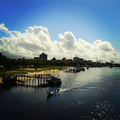
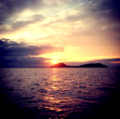
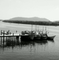


.png/120px-Insular_Biogeography_(Distance).png)
.png/120px-Insular_Biogeography_(Size).png)


.jpg/120px-Island_Birds_At_Sunset_(4856383999).jpg)


.jpg/120px-Kulusuk_from_the_plane_(entire_island).jpg)


.jpg/120px-Lake_Tahoe_(32953729465).jpg)


.JPG/120px-Last_light_(32625331514).jpg)
.jpg/120px-Laysan_Island_(7033581999).jpg)
.jpg/120px-Leaving_Nihoa_Island_(6887488666).jpg)

.jpg/120px-Leong_IMG_0943_(6689634585).jpg)
.jpg/120px-Lighthouse_at_Monomoy_National_Wildlife_Refuge_(4621670685).jpg)
.jpg/120px-Lighthouse_at_Monomoy_National_Wildlife_Refuge_(4622277802).jpg)
.jpg)


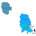
_(15035024645).jpg)
.jpg/90px-Maui_to_L%c4%81na%ca%bbi_(234881899).jpg)


.jpg/120px-Millerbird_holding_cages_(6887488466).jpg)
.jpg/120px-Monomoy_National_Wildlife_Refuge_shore_(4622277760).jpg)
.jpg/120px-Monomoy_National_Wildlife_Refuge%2c_MA._Credit-_USFWS_(5354887707).jpg)
.jpg/120px-Monomoy_National_Wildlife_Refuge%2c_MA._Credit-_USFWS_(5354887733).jpg)
.jpg/120px-Monumento_al_Marinero_(2856285580).jpg)
.jpg/89px-Moon_Fiji_(5210339747).jpg)


